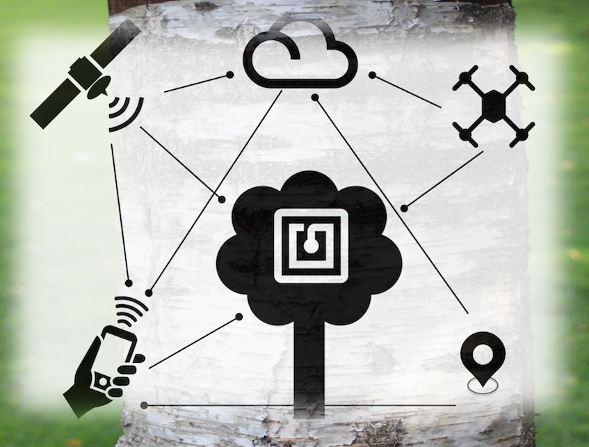
Specialised. Focused. Delivered.
EOXPLORE projects.

Green Cities

Improving the liveability of urban centres through Big Data analysis and ecosystem services. This project is developing smart IoT sensors to be deployed within cities to monitor environmental factors together with Earth observations to help improve urban living and resilience to pressures caused by climate changes. Services are being developed in partnership with Terranea.

I-REACT

Improving Resilience to Emergencies Through Advanced Cyber Technologies or I-REACT, is a project with over 20 partners developing a system for all the emergency phases using the latest cyber technologies, open data sources and models. The project aims to use social media, smartphones and wearables to improve disaster management as well as citizen participation. EOXPLORE is developing the wildfire and flood hazard models and automated mapping services.

ESA SEOM S2GLC (2016-2018)

The European Space Agency Scientific Exploitation of Operational Missions S2-4Sci Land and Water - Study 3: Classification project developed a fully automated land-cover classification processes for Sentinel-2 optical imagery. The project was led by CBK and in partnership with IABG and the Univ. of Jena. The project developed automated classification workflows for Copernicus Sentinel-2 imagery to produce a Global Land Cover Classification.

JRC Food Prices (2015-2016)

Working together with the Joint Research Centre of the European Commission (Seville), this contract analysed food prices data sources and collection methodoligies that are being applied in developing countries. The team looked into how crowdsourcing can be successfully applied together with Terranea.

EEA Forest (2015)

This project prepared and described for the European Environment Agency forest pattern metrics based on the HRL Forests pan-European product. Together with Terranea and Dr. Ostapowicz computed the Morphological Spatial Pattern Analysis using the Guidos Toolbox. The results provide insight into forest structure across the EEA39 countries.

EEA Land-Take and Imperviousness (2015)

How does soil sealing relate to land-take?. We looked at the Copernicus land services pan-European component HRL imperviousness change and CLC based land take datasets to understand the inter-calibration of indicators. We looked at the differences, commonalities, complementarity, added value and provided recommendations together with Terranea and Dr. Olah.

MELODIES (2013-2016)

The MELODIES project developed sustainable services based on Linked Open Data. EOXPLORE led the work package on Crisis Mapping Services and developed together with Terranea flood disaster and geospatial crisis mapping services.

FLOODIS (2013-2015)

Better flood information in your hands is FLOODIS. A Copernicus downstream service focusing on flood disasters in Europe. EOXPLORE developed the flood forecasting and nowcasting backend processing service. This video explains the project.

About Us

Geospatial technology is our specialty!

Being at the leading edge and pushing the computing envelope is what excites us.
Research, coding, and hardware tinkering is what our team does best.